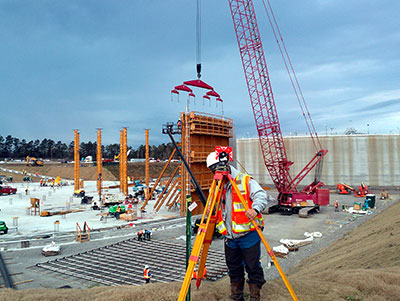
SURVEYING SERVICES
Our field surveying methods and techniques used to gather the survey data have been developed to adapt to the latest advances in technology and meet the ever changing needs of our clients. Conventional and robotic total stations and VRS capable GPS receivers give our survey crews the flexibility to quickly and accurately adjust to changing survey conditions. From small lot surveys to expansive solar farm sites, our survey crews start every project with the information, tools and experience to accurately and successfully execute the survey plan and complete the project to our clients’ satisfaction.
AREAS OF EXPERTISE
ALTA/NSPS Surveys
As-Built Surveys
Boundary/Site Surveys
Construction Staking and Layout
FEMA Elevation Certificates
Easement & Right of Way Acquisition
Landfill Surveys
Pond/Dam Topographic Surveys
Property Legal Descriptions
Geodetic/Global Positioning System Surveys
Horizontal/Vertical Control Surveys
Loan & Mortgage Closing Surveys
Property Subdivision Surveys
Residential and Commercial Site Surveys
Roadway & Utility Alignment Surveys
Route Surveys
Tree Surveys
Topographic Surveys
Wetland Surveys
FEATURED SURVEYING PROJECTS
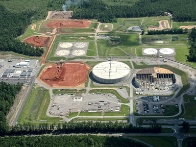
Savannah River Site Saltstone Disposal Unit Survey
Surveying services to aid in the construction of four (4) 32,000,000 gallon low level nuclear waste storage SDU tanks (Saltstone Disposal Unit) at the Department of Energy’s Savannah River Site. Services include: establishing and verifying site survey controls, drafting and calculation of staking points, plan verification, construction staking, as-built surveys, topographic surveys, and preparation of as-built plats for review by Savannah River Remediation. Members of our survey crews were required to complete drug testing, safety and protocol testing, as well as Federal background checks in order to obtain security clearance for this project. DN Tanks engaged AEC in 2018 to work on these tanks; it is anticipated that at least two additional tanks are slated to be constructed.

City of Columbia Survey
Project involved approximately 70,000 LF of surveying, locating the limits of the easement area boundary over selected gravity pipelines. The project consists of researching and gathering deeds of record for the horizontal location of the sanitary sewer force main easement boundary; field locate and monument the sanitary sewer force main easement boundary associated with designated force mains; and develop a plat showing location of monuments set to delineate the force main easement boundary.

USC Innovista Proposed Phasing Plan Survey
As-built and topographic surveys for the University of South Carolina on multiple parcels in support of the planning, design, and construction of privatized student housing and parking development projects. The scope included the location of all existing improvements, trees, landscaping and utilities, and to prepare a formal report outlining zoning requirements and existing utility infrastructure to assist in the design phase and planning of these projects.
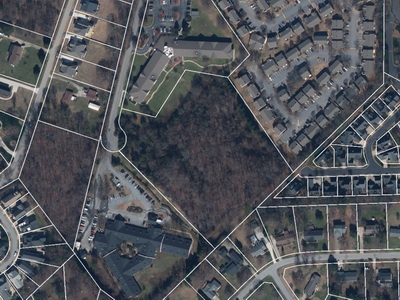
Greenville AEP ALTA/NSPS Survey, Mauldin S.C.
ALTA/NSPS boundary and tree survey on a 6.40 acre parcel to aid in the design and development of an assisted living facility near Mauldin, SC. Boundary and title documents were reviewed prior to the field survey to identify any existing easements on the property that could impact the site design. The boundary survey included the location of all improvements, utilities, roadways, and tree lines. This survey was tied to the SC State Plane Coordinate System through local geodetic monuments utilizing the latest GPS technology.

Ten Solar Sites, Community Energy Solar
Surveying services for ten (10) solar farm sites, including boundary, as-built, route and ALTA/NSPS surveys on ten individual parcels totaling over 1,280 acres in Calhoun County, South Carolina. Road and utility transmission line rights-of-way were identified in the preliminary phases of this project. Boundary, as-built, and ALTA/NSPS surveys were then performed on the lease portions of these parcels to aid in the design and development of a 72 megawatt solar farm.

Richland County Blythewood Boundary Survey
Performed ALTA boundary surveys on 20 individual tracts totaling over 1,350 acres in Blythewood, SC. Surveys were used as part of the planning and development of a new industrial park. Utilities, roadways, and improvements were mapped on all tracts. These boundary surveys were then consolidated into one master parcel for development purposes.

Harbison Grove Boundary, Topo, Wetland, and Tree Surveys
AEC provided professional surveying services to Map Land and Homes, LLC to aid in the site design and planning for the Harbison Grove Subdivision Expansion project. Our services included boundary surveys of four individual parcels totaling 19 Acres, topographic surveys producing elevation data at one foot contour intervals, wetland surveys to delineate existing wetland boundaries targeted for protection, and tree surveys based on local tree protection ordinances.

Nephron Pharmaceuticals Expansion Construction Staking
Construction staking completed on two sites near Cayce, SC to assist in the expansion of an existing manufacturing facility, and the construction of a new free standing research hub. Services included as-built surveys of existing buildings and utilities, recovery of site boundary monuments, setting new site survey control and bench marks, and staking building column lines for construction.
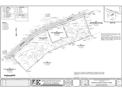
Beaufort Topo Survey, Dominion Energy
Surveying services in support of the design of a new Dominion Energy substation and storage facility in Beaufort County, SC. These services included boundary, topographical, and tree survey to map the location of parcel boundary lines, boundary monuments, road R/W’s, and the existing utilities and above ground improvements The topographic survey mapped elevation contours at 1 foot intervals, as well as storm drainage and sanitary sewer structures and drainage features. The tree survey was performed following Beaufort County Tree Ordinance requirements to plot the locations and sizes of specific tree types across the site.
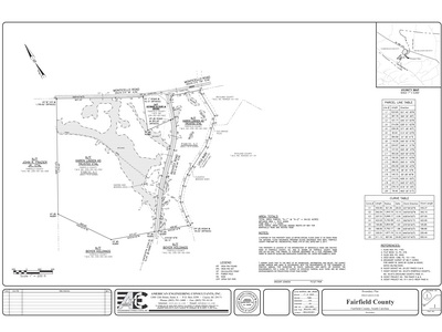
Fairfield Joint Water and Sewer System Survey
American Engineering Consultants (AEC) performed a boundary and wetland survey on the approximately 94 Acre tract located in Fairfield County, SC as part of the site evaluation and design of a new wastewater treatment plant for the Winnsboro/Ridgeland area. Survey grade GPS and conventional total stations were used to set survey control with SC State Plain coordinates, to locate the banks of the Little River, and to collect boundary, as-built and wetlands survey data.

Testimonial
“AEC stepped up to the plate and provided excellent service….We were very pleased that AEC went above and beyond to have adequate resources available to us, and they were always willing to accommodate our schedule.” – Eric Swift, DN Tanks
Designing the Future on a Foundation of Expertise for Over 30 Years
EXPLORE OUR SERVICES


